|
Total Area: 505,370 sq km
Land Area: 498,980 sq km Water Area: 6,390 sq km Climate description: temperate; clear, hot summers in interior, more moderate and cloudy along coast; cloudy, cold winters in interior, partly cloudy and cool along coast Terrain description: large, flat to dissected plateau surrounded by rugged hills; Pyrenees Mountains in north Arable Land Use: 27.18% Permanent Crop Land Use: 9.85% Irrigated Land: 38,000 sq km (2003) Total Renewable Water Resources:111.1 cu km (2005) Total Freshwater Withdrawal:37.22 cu km/yr (13%/19%/68%) Per Person Freshwater Withdrawal: 864 cu m/yr (2002) Natural Hazards description: periodic droughts, occasional flooding volcanism: volcanic activity in the Canary Islands, located off Africa's northwest coast; Teide (elev. 3,715 m) has been deemed a "Decade Volcano" by the International Association of Volcanology and Chemistry of the Earth's Interior, worthy of study due to its explosive history and close proximity to human populations; La Palma (elev. 2,426 m), which last erupted in 1971, is the most active of the Canary Islands volcanoes; Lanzarote is the only other historically active volcano Environmental Current Issues: pollution of the Mediterranean Sea from raw sewage and effluents from the offshore production of oil and gas; water quality and quantity nationwide; air pollution; deforestation; desertification Total Labor Force: 23.14 million (2012 est.) % of Labor Force in Agriculture: 4.2% Agricultural Products description: grain, vegetables, olives, wine grapes, sugar beets, citrus; beef, pork, poultry, dairy products; fish Click on the pictures for their links |
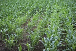
Corn field in Asturias. Spain
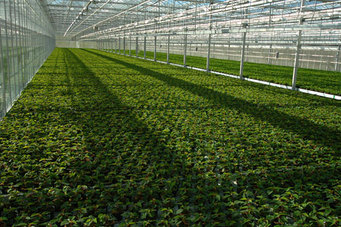
Highly developed greenhouses allow for high productivity on the agriculture marcket.
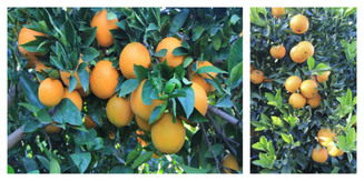
Spanish citrus production has grown from sustainable management in the traditional orchards of alluvial plains and fluvial terraces of Júcar to plantation on slopes without terraces
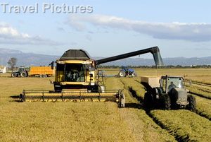
Rice Harvest. Delta Ebro River. Tarragona. Catalonia. The machinary allows for easier harvest and more product.
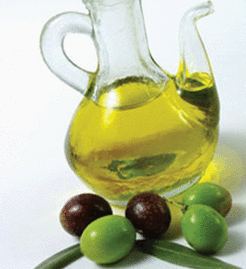
Spain is the world's largest producer of olive oil
|
